Tahoe to Capital Mountain Bike Ride Details
Challenge:
Black/Blue: Rated black because of strength and endurance to climb a steep and long uphill at elevation. Otherwise, this is a Blue rated ride.
Snow Valley Peak 9,218 ft at 39.1571499,-119.8724256
Trailhead:
Spooner Lake State Park 39.1074931,-119.9187489
Snow Valley Peak Tr: 39.153647, -119.895092
Ash Canyon Tr: 39.1773025,-119.8101275
Longview Way: 39.162395, -119.793638
The Ride:
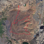
This is a serious hour climb from Spooner Lake to Snow Valley Peak even on an e-mtb. Traveling up North Canyon Road, as if going to Marlette Lake, at about 3.7 miles is the Snow Valley Peak Tr. junction on the right. From there is a steady 1.5 mi. double-track climb to the peak at 9,218 ft. While challenging, the views of the entire Lake Tahoe, the valleys to the East, and the flowing single track downhill are well worth it. Be sure to fuel up and hydrate as this is a big three hour adventure with short stops for fueling and water. Plan your ride with temperatures at elevation and the desert which can easily be a 30’ difference.
It’s called the Cap 2 Tahoe trail and on this shuttle ride we connected to the Kings Canyon trail, across Kings Canyon road, and continued on the Lincoln Connector trail that drops us off at Kings Canyon Rd and Longview Street.