Jacks Valley Loop Mountain Bike Ride Details
Challenge:
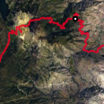
A steady undulating single track with climbs and descents.
Trailhead:
#1 Clear Creek Junction: 39.09189, Long: -119.80574
Located across the street from Clear Creek TH on Jacks Valley Road.
Trailhead #2 Jacks Valley Elementary School parking lot: 39.09236, -119.79916
Trailhead #3 James Lee Park: 39.08058, -119.78862
The Ride:
This is a fun early spring and late fall ride when snow is present elsewhere. There are a couple of trailhead variations and superb views of the valley. It’s a good trail for riders developing their mountain biking skills: climbing, shifting gears, braking and maneuvering around switchbacks. Narrow in trail sections, 18”, are present with short switchbacks, but no rocks or drop offs to negotiate.