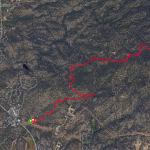
Stanford Rock Mountain Bike Trail Details
Challenge
A steady single track climb with swooping downhill turns.
Trailhead#1 Ward Creek Blvd: 39.136392, -120.180508
Trailhead#2 Parking Lot. Kilner Park, 659 Ward Ave., Tahoe City, CA 39.13517, -120.1571339
The Ride
Stanford Rock Mountain Bike Out & Back one of the best designed and built single track trails in Tahoe.
Initially, you cross the creek and hike/bike up 20 yards to access the trail. The climb begins on an old road. When reaching a junction turn right onto the improved trail. The trail snakes uphill on a smooth thread with stone reinforced berms with excellent turn radius. You will imagine the descent before getting to the top. Near the top you will encounter rocky trail, absence of soil, common for exposed peaks. The view is majestic. Overlooking Lake Tahoe and into Alpine Meadows ski resort now called Palisades. Enjoy a snack at the top with benches.
Caution. Slow down on the descent as the temptation to rip is high. Remember riders climbing have the right away so yield.


