Tahoe Mountain Loop Ride Ride Details
Challenge:
Medium steep climbs on smooth trail with a long descent on the backside with some small rocky sections.
Trailhead:
A good place to start is where Sawmill Rd. junctions with the Lake Tahoe Blvd Bike Path. You’ll see Sawmill Pond across the street from the Trailhead.
GPS: 38.888692, -120.027006 (Near junction of Lake Tahoe Blvd. and Sawmill Rd.)
The Ride:
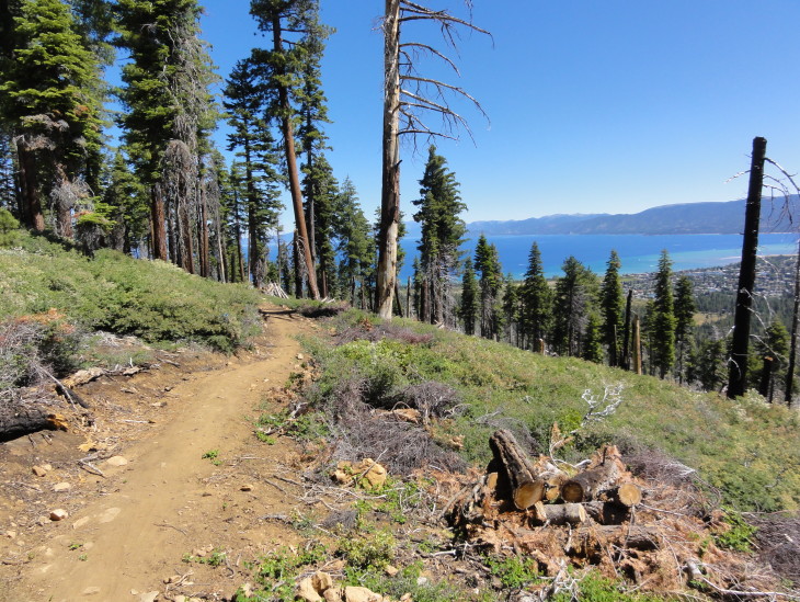
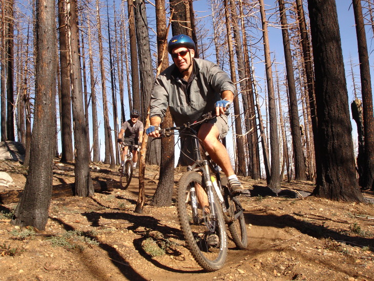
A newly re-routed single track with a couple of loop options that provide spectacular views of Christmas Valley to the South, Pyramid Peak, Desolation Wilderness and Mt Tallac to the West, and to North East you will see the Lake’s beautiful colors change as the depths increase from the shore. When you reach the top ridge line, stay to the right and you will traverse the mountain and descend into the Angora Fire burn area. You will come to a junction, turn right for the Loop that takes you behind the High School and connects to the bike path.
Ride Options: Frontside Loop. On the first single track junction at the ridge top turn left and you will loop back on a fun downhill to your starting point. Fallen Leaf Lake Loop. To extend your ride to Fallen Leaf Lake, turn left at the trail junction at the bottom of the descent, in the burn area, where if you turn right, you would be returning to the trailhead.
Preview Ride:
Historical:
Near the trailhead is the remnant sawmill foundation built and operated by the Celio family from 1860-1890’s during the Comstock logging period. In 1922, the family built a steam-powered mill across the street at the present Sawmill Pond site. The Celio family owned 13,000 acres in the Meyers and Christmas Valley area. Their ranch house can be seen on South Upper Truckee road.
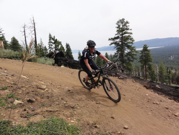 Banked turn descent